
Follow a New Martinsville Street
The most dependable street directory trail moves from map to parcel to recorded instrument. Begin with the spelling shown on the official WVDOT city map. Keep the original form too, since older records may shorten Street to St or preserve a former road label. The map supplies orientation, but it does not identify a parcel owner or occupant.
- Normalize the street and house number. Check the postal form, then note whether the source calls it physical, mailing, or E-911.
- Open the WV Property Viewer. Locate the parcel geometry by E-911 address or parcel attributes.
- Read the assessment card for the owner label, parcel ID, legal description, tax class, and prior-owner or sale fields.
- Take book, page, parcel, names, and a rough date to the Wetzel County Clerk. Inspect the deed rather than treating an index result as the record.
- For a dated household clue, consult the voter rules or a historical directory. Neither source should be turned into a claim of current occupancy.
This sequence makes gaps plain. A map can show a lot that has no street number. One tax parcel can contain more than one card or structure. The deed identifies a recorded transfer, while a directory is only a snapshot for one edition year. When the aim changes from a full street to one named person, use the New Martinsville resident lookup and corroborate that person across sources.
Search New Martinsville Streets by Field
The official West Virginia assessment search offers far more than a blank address box. Select Wetzel County, add a district if known, and use the street field to browse one road. Owner, map, parcel, class, tax class, subparcel, and land-use fields can narrow a broad result. Advanced controls cover appraised value, acreage, sale dates, and sale price. No ZIP field was observed, so do not force a ZIP search into this system.
| Search control | Useful input | What it narrows | Limit |
|---|---|---|---|
| County and district | Wetzel plus district | Jurisdiction and tax area | District may be unknown |
| Street | Name, with suffix variants | Parcels along a road | No ZIP filter observed |
| Owner | Name on the tax roll | Property connection | Owner is not an occupant |
| Map and parcel | Tax-map identifiers | One parcel or small set | Format must match the roll |
| Advanced values | Acres, value, sale date | Large street result sets | Figures need date context |
The official assessment form shows the controls used for New Martinsville by-street work.
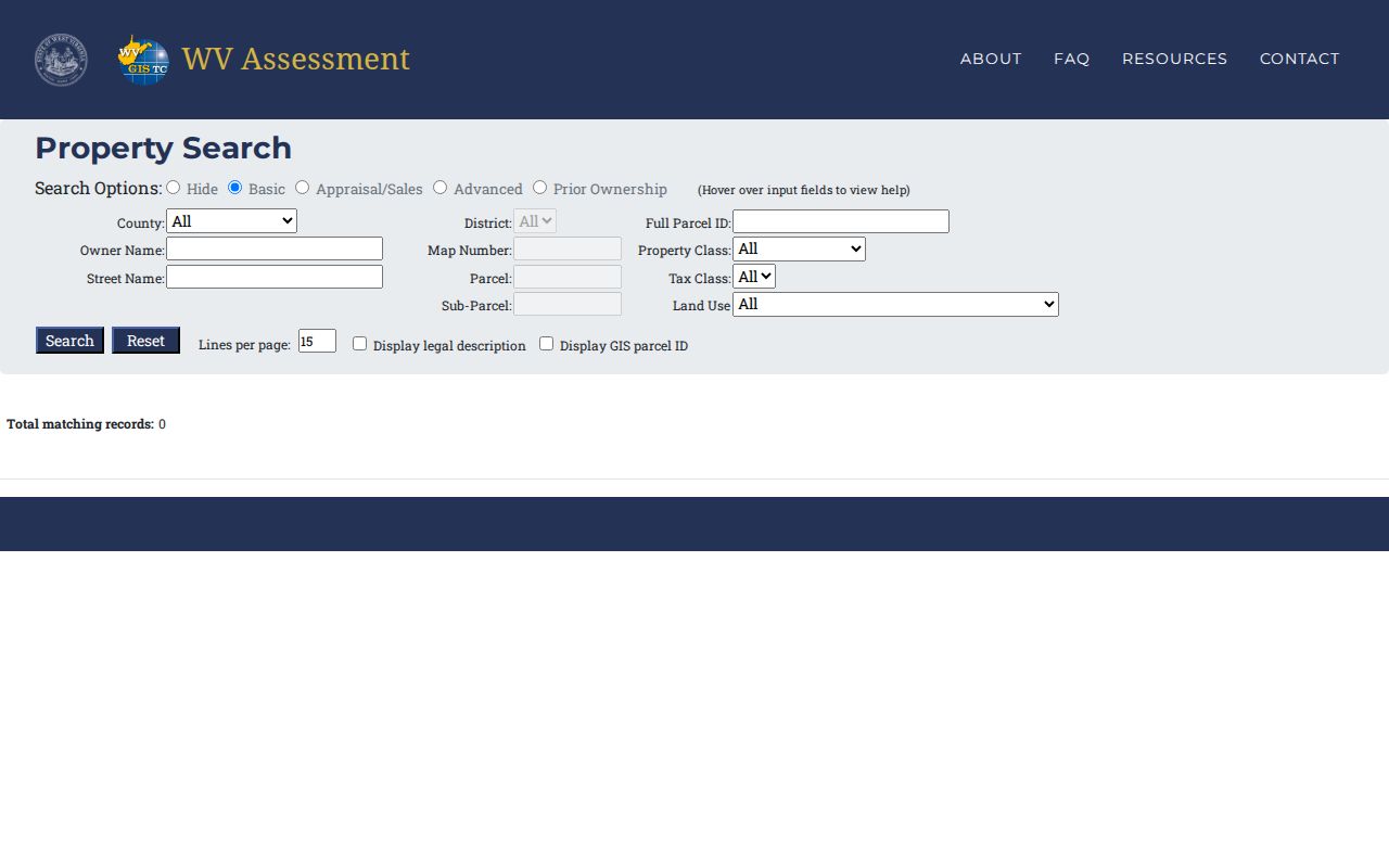
Use its result as a dated tax-record lead, then open the linked card for address labels and document references.
Map New Martinsville Street Parcels
The WV Property Viewer connects a street label to geometry. Its E-911 mode uses the Statewide Addressing and Mapping System and excludes rural routes and post-office boxes. Parcel Attributes accepts county, parcel number, property owner, or property address. Owner searches can use part of a name in LASTNAME FIRSTNAME order. Geometry tools help identify adjoining lots when a house number is absent.
Results stop at 500, and the viewer warns that multiple assessment cards for one unique parcel may not display in full. Narrow a large New Martinsville street directory search before drawing conclusions. Open each likely parcel on its own. The map may link tax maps, flood context, legal description, and the assessment detail, but it is still a GIS product rather than a deed.
The public parcel viewer shows the map and address modes used in this workflow.
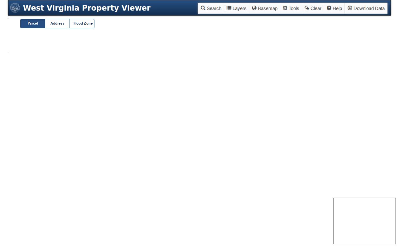
Its parcel outline identifies the next tax card, not who is inside a structure.
Note: A broad search may hit the viewer cap, so add a parcel, address number, district, or map reference.
Four New Martinsville Address Labels
A public city-owned sample parcel shows why exact labels matter. The owner mailing address is 191 Main Street. The card gives 527 Main Street as the physical address and 527 Market Lane as the E-911 address. Those three entries describe different functions within one record. A fourth label, the USPS form, may standardize delivery without proving that any person or company is there.
- Parcel
- A unit of land identified by a county tax-map number.
- Situs address
- The physical location assigned to property, which can differ from mail routing.
- Plat
- A recorded drawing that sets out lots, lines, roads, or a subdivision.
- Criss-cross directory
- A historical directory section arranged by street and house number instead of surname.
The official sample parcel detail makes the label conflict visible.
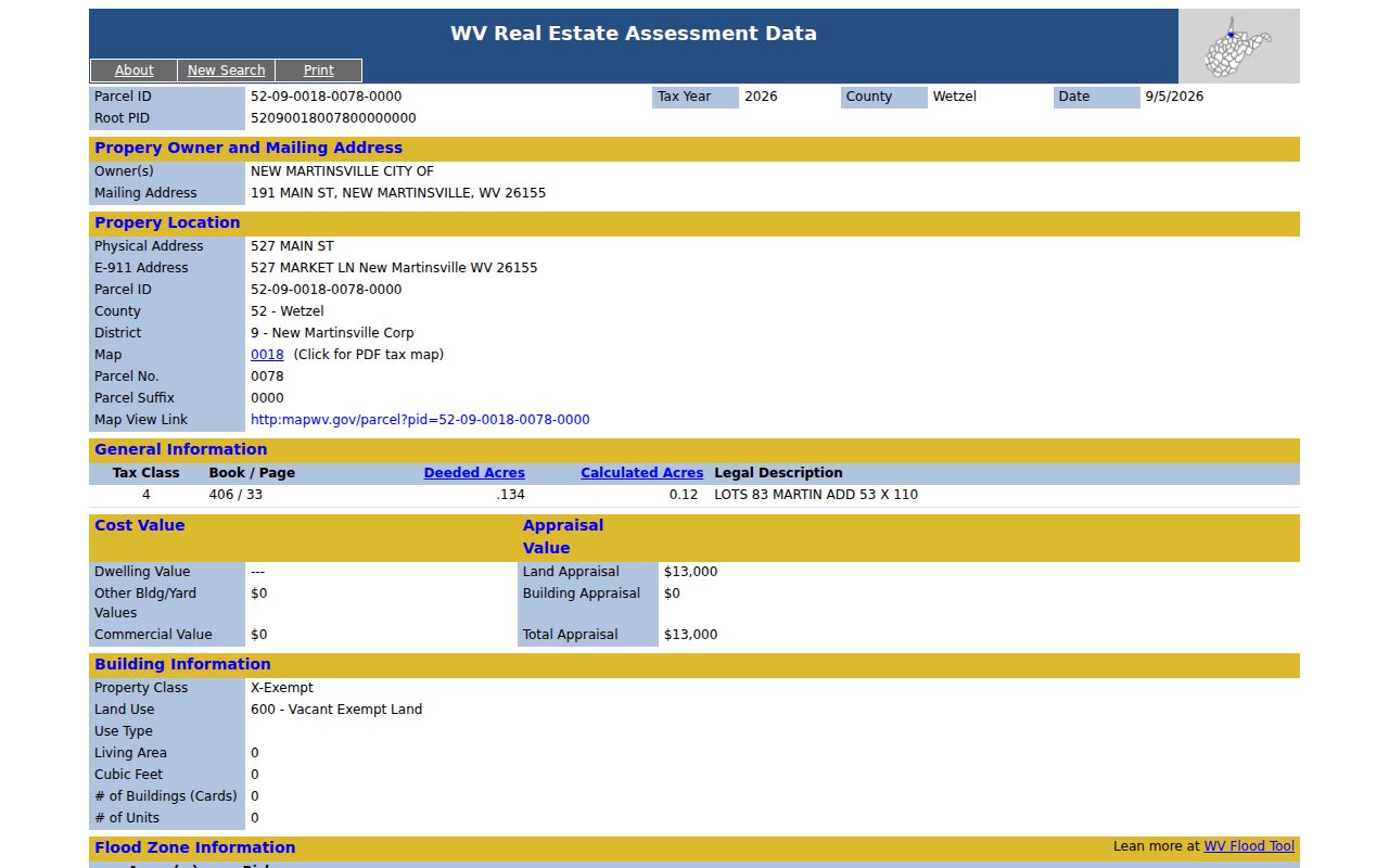
Record each label exactly and add the date checked. Do not silently replace one with another.
How Wetzel Roads Get Numbers
The county E-911 addressing FAQ explains a rule specific to Wetzel County. New road numbers use 5.28-foot intervals, creating 1,000 possible address numbers per mile, split between 500 odd and 500 even numbers. Shared driveways can receive a road name when county criteria apply. Duplicate numbers, A/B suffixes, a bad sequence, or an odd-even error can lead to one home or a whole road being readdressed.
A change may take about one year to flow through mail systems. The county says there is no cost, post-office boxes are not changed, and residents must update agencies and contacts. Thus, an old street directory entry and a present parcel card may both be accurate for their own dates. Search the legal description, lot, prior owner, and nearby parcels when a former number disappears.
The county FAQ is the source for this road-numbering process.
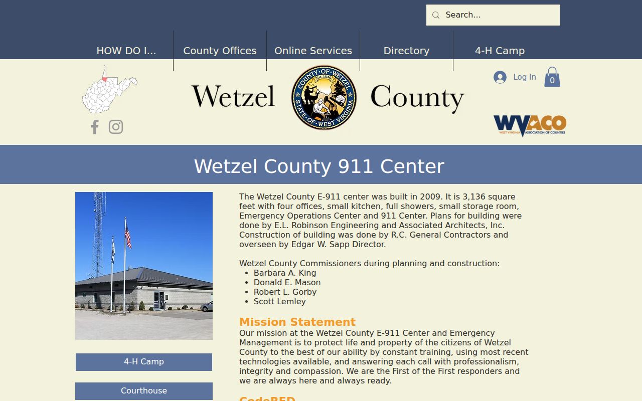
The interval rule explains apparent address conflicts without assuming that a person moved.
New Martinsville Records by Street
Each address-keyed source answers a different question. A useful street directory states the keeper, access path, and proof limit rather than merging all results into one household claim.
| Address record | Keeper | Street-level value | Access |
|---|---|---|---|
| Assessment card | Wetzel Assessor and WV Tax Division | Owner, parcel, situs, class, value, sale history | Online or assessor office |
| Parcel geometry | WV Property Viewer | E-911 address, boundaries, adjacent parcels | Public viewer |
| Deed or instrument | Wetzel County Clerk | Grantor, grantee, book/page, legal description | Portal gate or office request |
| Building permit | City Building Department | Owner, site, project, floodplain, approvals | City Hall; no public index found |
| E-911 address | Wetzel County E-911 | Emergency label and readdressing context | FAQ and office |
| Historical listing | Archives or library | Dated name and address clue | Selected editions |
Assessment and GIS screens are the fastest start. The deed and permit may require a visit, call, email, or written request. West Virginia FOIA permits a focused request to a public body, subject to exemptions and the office's record system.
Confirm New Martinsville Street Owners
The Wetzel County Clerk keeps deeds, oil and gas leases, liens, wills, probate records, appraisements, and miscellaneous instruments. The county links a Document Inquiry portal, but a CAPTCHA prevented inspection of its full field set and coverage. Treat that online route as a convenience. The Clerk's office is the authority.
For one street parcel, bring the current owner label, map and parcel, book/page if shown, legal description, instrument type, and approximate date. Ask whether the desired copy is certified or uncertified. A grantor transfers an interest; a grantee receives it. Neither word establishes that either party lived at the address. The legal description often remains useful when an E-911 number or street form changes.
The county document inquiry was captured at its public gate.
If the gate fails, call the Clerk at 304-455-8224 or request the named instrument from the office.
New Martinsville Permits Stay Offline
The New Martinsville Building Department supplies a rich address record, but no public permit search was found. Its five-page application asks for the property owner, exact construction location, floodplain status, project and demolition details, contractor, street and lot measurements, easements, setbacks, utilities, subcontractors, and agency approvals. The form helps frame a precise request. It is not proof that a permit was issued at a given address.
Contact the department at City Hall, 191 Main Street, by calling 304-455-9130. Give the number, street, approximate work date, and project type. Ask for the final permit or inspection record, not a blank form. Some interior work under $2,000 may not require a permit when it has no electrical, plumbing, or structural work. Those trades generally do require one. A missing permit can thus reflect the work category, not a missing property history.
Read New Martinsville Street History
The Wetzel historic resources survey adds a building layer to Main, North, and Maple streets. It dates examples from about 1910 through 1950 and identifies Colonial Revival, Craftsman, Victorian, and Romanesque Revival forms. That context can explain an old structure, addition, or lot pattern. Architecture does not identify a household.
Pair the survey address with a parcel ID and legal description. Then look for a deed, dated directory entry, museum image, or library clipping. The town was platted as Martinsville and did not adopt New Martinsville as its official name until 1871. Historical catalog searches may need both place names. The New Martinsville city directory collections provide the edition-based layer without rebuilding it here.
Note: No verified citywide street-renumbering year or before-and-after crosswalk was found, so do not match old and new numbers by guess.
Limits of New Martinsville Street Records
A parcel owner is not always an occupant. A mailing address may belong to a public office, an estate, a trust, or an owner who lives elsewhere. A vacant, exempt, civic, or utility tract can appear beside homes. One parcel may have several structures, and one structure may not map to a separate tax card. USPS explicitly warns that an address result does not confirm that a person or company is present.
Voter records add only a limited election signal. West Virginia's public voter rules exclude phone, email, Social Security, and driver-license or ID numbers. The Address Confidentiality Program can place a substitute address in public-facing systems for eligible survivors. Those protections favor publishing the least person-level detail needed for a lawful task.
Lawful use. Use New Martinsville address records for personal research, civic review, or house history. West Virginia law prohibits stalking and harassment, and protected addresses must not be used to locate or harm anyone.
State the source and date for every result. Say “owner of record,” “mailing address,” or “directory listing” rather than “resident” unless the source establishes that fact. This keeps a New Martinsville street directory useful without unsupported claims about private lives.
Check New Martinsville Street Matches
Before saving a match, compare the parcel number, legal description, address type, source date, and office that created the record. A shared surname or similar house number is not enough. Keep screenshots or citations with the query terms used, especially when a portal changes its host or returns only a capped set.
When two sources conflict, ask the office responsible for the disputed fact. E-911 resolves emergency labels, USPS standardizes mail, the Assessor explains tax cards, and the County Clerk authenticates recorded instruments. That division keeps a by-address result precise.