
New Martinsville ZIP Coverage
Official material supports one primary city postal code and one nearby exception that needs a careful label. ZIP 26155 is the standard New Martinsville postal identity. ZIP 26162 belongs to Porters Falls, yet USPS historical sorting and place-name notices connect it to the broader New Martinsville processing context. It should not be presented as a second equivalent city ZIP.
| Postal code | Verified place | Postal facility | How to use it |
|---|---|---|---|
| 26155 | New Martinsville primary postal area | New Martinsville Post Office, 230 Main Street | Use for city-address checks, then confirm the parcel and city line |
| 26155-9998 | Facility ZIP+4 shown for the post office | New Martinsville Post Office | A facility-specific extended code, not a separate city area |
| 26162 | Porters Falls | Connected in USPS place-name and sorting material | Treat as a nearby postal exception, not proof of New Martinsville city residence |
The New Martinsville ZIP code directory therefore uses a short verified list rather than padding it with every code in Wetzel County. Pine Grove, Paden City, Hundred, and other county communities have their own postal identities. A Wetzel County label does not make those addresses part of New Martinsville. Always preserve the city or postal place printed by the official lookup.
New Martinsville ZIP 26155
The New Martinsville Post Office is listed at 230 Main Street with the facility code 26155-9998. USPS location details provide current retail and service information, but those details can change. Check the office page before relying on hours or a service window. For address work, the key distinction is between the five-digit area code and the extended ZIP+4 assigned to a specific delivery point or facility.
Use 26155 as a postal filter, then test the address against the county's land and emergency-address systems. The tax record may use an owner's mailing address, a physical or situs address for the parcel, and an E-911 address. Each label answers a different question. A postal match supports mail routing. It does not prove that the named person owns the parcel or occupies it today.
Postal limit. USPS says its ZIP and address tools do not confirm that a person or company is located at the address entered.
Porters Falls ZIP Exception
ZIP 26162 is a genuine local quirk. A 2010 USPS Postal Bulletin expanded the Porters Falls place-name and delivery context, while an archived USPS sorting table groups 26162 with New Martinsville routing. Those documents support a postal relationship. They do not redraw the municipal boundary or turn Porters Falls into a New Martinsville neighborhood.
This matters when searching historical mail, a parcel, or a family record. A document may say New Martinsville because of processing or a preferred mailing label, while the physical location belongs to Porters Falls. Record the exact label and date from the source. Then check the parcel jurisdiction, emergency-service address, and city map before calling it a city address. The New Martinsville ZIP code directory keeps 26162 visible precisely because hiding the exception can cause a false match.
Search New Martinsville Postal Records
The USPS ZIP Code Lookup offers three useful search modes. Each answers a different postal question. The USPS screenshot failed during capture, so no image is shown here; the official live tool remains the right source.
| USPS mode | Fields supplied | Best use |
|---|---|---|
| By Address | Street address plus city and state | Normalize a full delivery address and retrieve its code |
| By City and State | City and state | List postal codes associated with a named place |
| Cities by ZIP Code | Five-digit code | Check the preferred or accepted postal place names |
Start with By Address when the street number is known. Use City and State to check the general New Martinsville postal set. Reverse a code through Cities by ZIP Code when an old document supplies only the number. Copy the returned city name as shown, but do not convert it into a city-limit claim.
Find New Martinsville Records by ZIP
A ZIP code directory narrows the candidate area before the record search begins. The Wetzel County Assessor's online tools accept owner name, street, map, parcel, district, property class, land-use code, values, and sales details. The research did not verify a dedicated ZIP field on that assessment form. Search by the normalized street or owner, then read the address and parcel labels in the result instead of claiming a ZIP-wide assessor filter.
- Enter the full address in USPS lookup and save the standardized postal place and ZIP.
- Search the Wetzel assessment system by street, owner, map, or parcel. Note the mailing, physical, and E-911 labels separately.
- Open the WV Property Viewer for parcel geometry and the emergency-address layer. Avoid broad searches that can hit its 500-result limit.
- When a voter record is relevant, use the Secretary of State self-check with first name, last name, and birth date. Do not browse it as a ZIP list.
- Once the area narrows to a named road, continue through the New Martinsville Street Directory for the parcel and deed workflow.
The order protects against a common error: treating the code printed on mail as a complete geographic record. Postal, tax, election, and emergency systems were built for different tasks. Agreement across them is useful. Disagreement needs labels and dates, not a forced answer.
Three New Martinsville Address Labels
A public civic parcel supplies the clearest local example. Its assessment detail showed 527 Main Street as the physical address, 527 Market Lane as the E-911 address, and 191 Main Street as the public owner's mailing address. All three labels can be correct because they serve different systems. None should be silently substituted for another.
The official sample parcel detail is the source for that contrast.
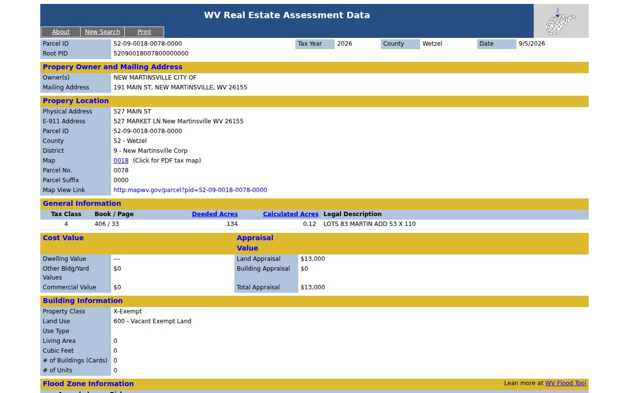
The captured parcel card shows why a ZIP code lookup cannot settle every address question. Read the field name beside each address, preserve the assessment date, and use the parcel identifier or legal description when street labels conflict.
Wetzel E-911 Road Numbers
Wetzel County's E-911 rules add an unusually exact geography layer. New road numbers are based on 5.28-foot intervals, producing 1,000 possible numbers per mile, split into 500 odd and 500 even positions. A shared driveway may receive a named road. The county can readdress a whole road when numbers are duplicated, out of sequence, use A/B suffixes, or fall on the wrong odd or even side.
The Wetzel County E-911 addressing FAQ explains those standards and the update process.
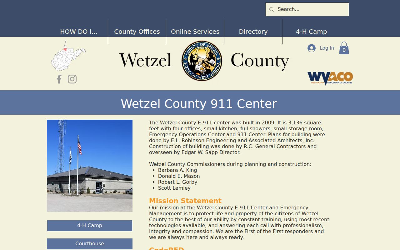
The county says address assignment has no cost, yet a change can take about a year to reach all mail systems. That lag explains why an older directory, parcel card, USPS result, and emergency address may disagree even when they refer to one place. Search both old and new forms when tracing a New Martinsville address.
New Martinsville ZIP and City Limits
A ZIP is a delivery area, not an incorporated boundary. New Martinsville is the Wetzel County seat, but its postal reach and its legal city line are separate. The same caution applies to tax districts and voter precincts. An address can use a New Martinsville mailing label without proving municipal status, and the Porters Falls exception shows why the city name cannot be inferred from the sorting route alone.
- ZIP and ZIP+4
- The five-digit code identifies a delivery area; the extra four digits narrow a delivery segment or point.
- PO-box ZIP
- A code or extension used for post-office boxes rather than a mapped residential street.
- Unique ZIP
- A code assigned to one high-volume organization. No unique New Martinsville code was verified.
- Carrier route
- A postal delivery path within a code, not a city ward, precinct, or parcel boundary.
- Situs address
- The physical location assigned to land or a building for property-record purposes.
For a boundary question, use the official city map and parcel geometry, then ask the city or county office if the line remains unclear. For a delivery question, use USPS. Keeping those roles apart makes the New Martinsville ZIP code directory accurate and useful.
Normalize Older New Martinsville Addresses
An older family record may predate a modern E-911 number, carry a rural-route label, or use the city's earlier name. Presley Martin platted Martinsville in 1838, the town incorporated as Martinsville in 1848, and “New” entered the official name in 1871. Early records should be searched under both place names. Combined directories may also name Paden City or Sistersville in the title.
Begin with the wording on the dated source. Match its legal description or parcel when possible. Next, check a later city directory, deed, assessment card, USPS form, and E-911 record in date order. A legal description is often more stable than a road number. If the road was readdressed, ask the E-911 office whether it can confirm the prior label. No public before-and-after crosswalk was located during research, so do not invent one.
Limits of ZIP Resident Searches
A New Martinsville ZIP code directory can sort addresses and explain postal place names. It cannot provide a complete roll of everyone inside 26155. The assessor identifies property ownership, not every person at the site. The voter tool is a personal registration check, not a public ZIP browse. USPS normalizes delivery labels but disclaims person or company confirmation.
Use only the minimum detail needed for family research, an estate matter, address history, or civic inquiry. West Virginia's Address Confidentiality Program may replace an eligible survivor's real address in government dealings, and no search should try to defeat that safeguard. Correct an inaccurate result with the office that owns the record. Do not use address or postal data to monitor, intimidate, or harass anyone.